Episode 5: Greymouth to Queenstown
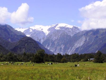
View of Alps near Franz Joseph
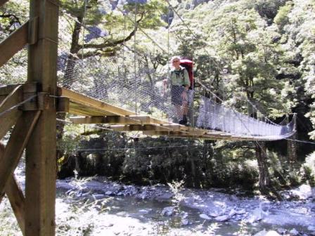
Swing Bridge over Young Creek
Read Previous Episode
Nelson to Arthur’s Pass or Next
Episode 5: Page 1 of 2 Greymouth to Makarora
Tuesday 29 January
2002, Queenstown NZ
Skip to Episode 5: Page 2
Wanaka to Queenstown
Pancakes, Ice and More Peaks
Ode to NZ Weather
(Compliments of Celia and Beattie. A copy of this was
also on display in one of the DOC offices we visited.)
It rained and rained and rained
The average fall was well maintained
And when the tracks were simply bogs
It started raining cats and dogs
After a drought of half an hour
We had a most refreshing shower
And the most curious thing of all
A gentle rain began to fall
Next day also was fairly dry
Save for a deluge from the sky
Which wetted the party to the skin
And after that the rain set in.
Just a note: some of you may have read about a
Canadian woman from Montreal who was killed tramping in
NZ. No, it was not me, but as you will read later on in
this Episode, we were on the same tramp as the one that
ended in disaster for the Canadian couple. Yes, we were
very careful and we had no troubles at all. There was
also news of a Canadian couple killed in a plane crash.
Once again we are still alive and kicking, but we did
enjoy a short, small plane ride (see later).
Yes, the weather seems to have finally co-operated for
us. Maybe NZ really does have a summer. We hope, for
those of you who enjoy winter, that the snow has finally
come and that it is not too cold to enjoy the outdoors.
We are still doing well and enjoying life. We keep
meeting great people from all parts of the world and
enjoying all the natural wonders NZ has to offer. I can’t
believe we have been here for two months. We are starting
to wonder if we can fit in all the rest of the places we
want to visit. As we have been told, you can’t do
everything and there can always be a return trip.
We left Arthur’s Pass on Friday 18 January, picking up
a young hitchhiker as we left town. We try to do this
whenever we can and have always been pleased to talk to
the mostly-young travelers. Hitchhiking is very popular
among travelers in NZ and appears to be quite safe,
unlike many other countries. The scenery just west of the
town of Arthur’s Pass was spectacular. The road goes up
and down between the mountains on a 16% grade. We were
behind a truck going very slowly so we had lots of time
to admire the view.
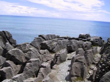
Pancake Rocks
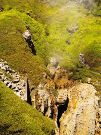
Pancake Blowhole
The trip to Greymouth, on the
West Coast, was only about 1-½ hours, so we were there
in plenty of time for sightseeing in the afternoon. After
lunch we drove a short distance up the coast to arrive at
the famous Pancake Rocks and Blowholes just before high
tide. The Pancake Rocks are like piles of thin crepes,
formed by the compression of layers of limestone. The
pressure was so high that some of the layers liquefied
into mud and compressed the layers further. The wave action
has carved caves, bridges and pools into the rocks. At
high tide, the waves are so strong that the backlash
against the rocks causes spray to shoot up through holes
in the rocks to form mini geysers. We were there in time
to witness the display through at least one of the
blowholes. The area is rather touristy, but very well
done, with well kept landscaped paths leading onto the
rocks. The crickets in this part of the country are the
loudest we have ever heard. It was a warm day and the
noise was almost deafening on the path to the rocks.
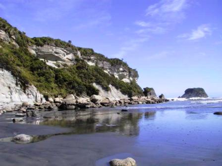
Point Elizabeth
We stayed in Greymouth for another day to relax and
take in a day walk. Each town boasts several, so we like to take a
sampling of the best. That day we took a short walk to
Point Elizabeth for coastal views. From the point you can
climb down aluminum ladders bolted into the cliffs to
walk along the beach to the town of Rapahoe. Like many of
the beaches on the South Island, this one was a driftwood
collector’s dream. It was littered with large logs and
tree stumps. It would have taken some mighty storms to
get some of those stumps up on the beach. The return path
was through a rain forest; so dense you could see only a
few feet into the trees. We have been told that this is
coastal rainforest country, so hence the number of wet
days. We hope most of those wet days are behind us.
The local theatre in Greymouth was showing the Harry
Potter film, so we went. The story was gripping and very
well done. I read one of the books on our trip last year,
but I hadn’t read the first one, but it was fun. Seeing
movies is a great bargain for us in NZ. First of all we
get a good exchange on the NZ dollar and second, Ray has
been asking for Senior rates. You have to take advantage
of these little perks as you get older.
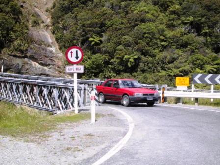
Single Lane Bridge
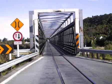
Single Lane bridge shared by train
Our next stop was the Glaciers on the West Coast. We
had made a reservation for
an all day, guided tour on the Fox Glacier, but we
stopped to see the Franz Josef Glacier on our own. The
skies were clear and blue all day so we had good views of
the snow-capped peaks from the time we left Greymouth all
down the coast. We stopped along the way to take photos
of some of the NZ bridges. Only in NZ, you say, good
thing. Most of the bridges, even on the main roads, are
one lane wide. Painted on the road as you approach the
bridge is a big ‘One Lane Bridge’ or ‘Give Way’ warning.
The road sign next to the bridge has an arrow in each
direction. If the arrow is red on your side, you are
expected to stop. The added extra on a few of the bridges
south of Greymouth is the railway track going down the
middle of the bridge and a sign to ‘Give Way’ to the
train. One could hardly refuse.
In Franz Josef we drove to a car park just out of town
and walked along a stone river bottom until we were as
close to the foot of the glacier as we were allowed. It
was an impressive sight with waterfalls coming out of the
rainforests on both sides and the big tongue of blue ice
dropping to the river bottom. The Franz Josef and the Fox
Glaciers are the only ones in the world that exist next
to a rainforest. The end or terminal of the glacier had a
large ice cave from which a rushing stream flowed. The
water was too wide to cross, so the area is roped off to
all but guided tours. We took lots of photos, and then
continued on to Fox Glacier, where we booked into a
backpackers hostel.
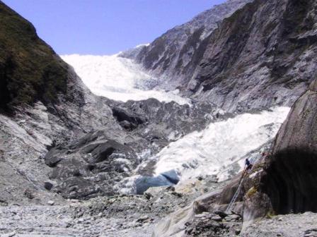
Franz Joseph Glacier
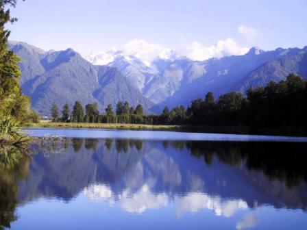
Alps reflected in Lake Matheson
Fox Glacier is smaller than Franz Josef, with a
permanent population of just 50 people. This swells in
the summer tourist season with helicopter companies
offering scenic rides and several hotels and restaurants.
The town is built too close to the glacier to get any
views. We arrived to see a cloud hanging low in the
valley containing the glacier, but it started lifting in
the evening. The best views of the glacier are from
Lake Matheson, about 4 K away. We drove out after 7 PM
and walked around the lake, stopping at all the
designated viewing points. The highlight is to be there
when the skies are clear and the waters are still to
capture the reflection of Mt Tasman, the Glacier and Mt
Cook in the waters. We got the best views possible for
several days as the clouds lifted enough to uncover the
peaks and the wind died enough for the reflections to be
visible.
We had a great day exploring the Fox Glacier. We
reported to the guiding company office at 9:15 to join
ten other tourists and get outfitted with boots and
crampons. The day was nice and warm but our guide, Abel,
warned us to bring warm clothes to wear when we were
walking on the ice. We all piled into an ancient bus and
drove a short distance to the Fox Glacier car park. Along
with other tourists, we walked to the base of the glacier.
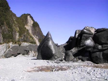
It looked as if a front-end loader had just dumped a load
of gravel and rocks onto the path, but this was the
debris left from the recession of the glacier. Unlike the
Franz Josef, you can walk almost, but not quite, up to
the terminal of the glacier. The glacier had been
receding at a rapid pace until 1985, when it started
advancing again. This phase only lasted until 1999.
Currently the glacier is receding again at a rate of 1 cm
per day. Abel pointed out a huge boulder beside the
glacier that he said was covered in ice when he started
guiding just two years ago.
Moraine Ice on Fox Glacier
Steps to walk up Fox Glacier
Fox Glacier Cave
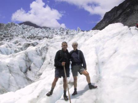
Ray and Jeanne on Fox Glacier
We followed Abel
on a path through the rainforest on one side of the
glacier until we came out on the rocks farther up the
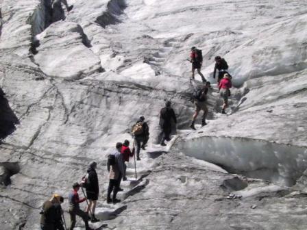
glacier. Here we put on our crampons and walked gingerly
across the loose stones to a set of stone steps cut into
the ice. With the warm weather, the ice is quite soft and
the crampons dug right into the ice. I found it a lot
easier to walk on the ice than over the rocks. Abel led
us overthe smoother lower section of the glacier, cutting
ice steps with his pickaxe as we went, to the more rugged
upper section. He explained how
the distinctive blue colour of the ice is caused by the
refraction of light. Light reflects light, so is blue or
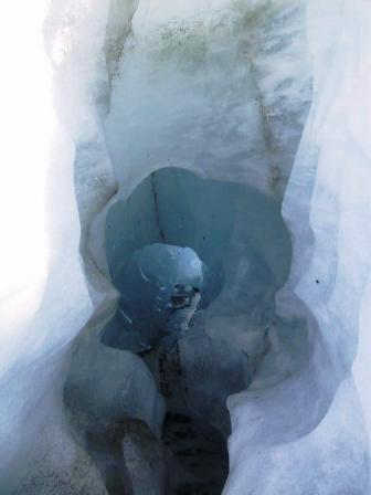
grey,depending on the sky. We marvelled at huge holes, or
‘moulins’, bored into the ice by underground stream and
Abel found us an ice tunnel to crawl through. It was
like walking through a cold, blue igloo. We ate our lunch
on a boulder the glacier had left on top oft the ice,
then walked a bit farther towards the ice fields. These
huge rectangular boulders, surrounded by deep crevasses
are too dangerous to walk on, as they are constantly
moving. Eventually we made our way back to the terminal
of the glacier. We had heard a
large boom while we were up on the glacier and the cause
of the noise was before us at the base of a huge ice cave.
Several huge chunks of ice had broken off and crashed to
the ground. There are good reasons to treat the glaciers
with respect.
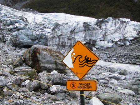
Warning sign on Fox Glacier
We had read about an interesting tramp in Mt Aspiring
National Park, south of Fox Glacier, so Tuesday, January
22 we drove to the small community of Makarora (landing
strip for a small plane offering scenic flights, gas
station, tearoom and cabins) to investigate. The Lonely
Planet Tramping in NZ calls this the Wilkins-Young tramp,
because you walk next to the Young and Wilkins Rivers,
but the local DOC refers to it as the Gillespie Pass. The
DOC office assured us the conditions on the trail were
good and even the river ford, which starts the tramp and
was not very appealing to me, was not very deep. We
decided to go for it. We were glad we did. It was
probably the longest and most demanding tramp we have
done so far, but the views made it all worth while. The
only negative was advice from the DOC to take our
Thermorests with us in case the 10 beds in the Young Hut
were full. We needn’t have bothered as like many of the
huts, they had plenty of extra mattresses, plus we
arrived early enough to claim a lower bunk.
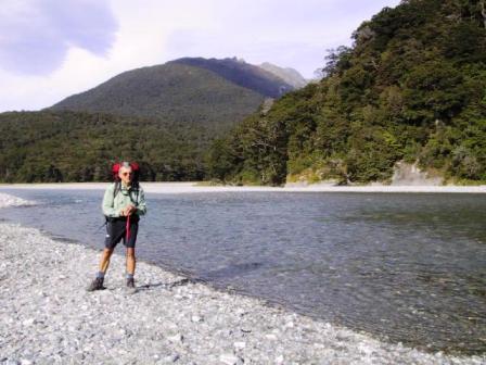
We must ford the Makaroa River
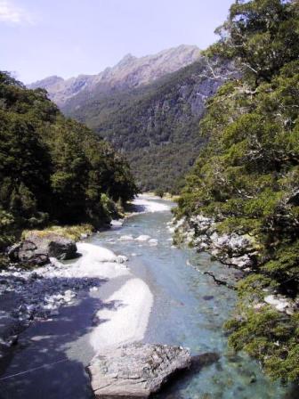
Young Creek
We
stayed overnight in Makarora and left our cabin early the
next morning at 8:00 AM, in nice sunny, but not too hot,
weather. The hardy kiwis just paddle across rivers in
their boots and but I dislike hiking in soggy boots. I
decided to change into my sandals and was glad of it. The
water was glacial cold and
came up to my knees in places, but I was wearing shorts
and found it easy to walk across with my pack on my back.
Ray had read that you should take off your socks but wear
your hiking boots, so of course his boots had to be
emptied of water on the other side of the river, plus he
had to stop a little further on and wring out his now
soggy socks. It was a long day, but pleasant, mostly
through the trees beside the rushing Young Creek. The
trail was mostly level until after our lunch break when
we began climbing. We had gained 650 M by the time we
reached the Young Hut (1000 M) at 4:40 PM.
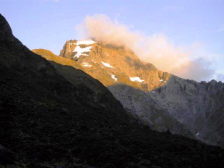
Sunrise over Mt Awful
Young Hut was
just above the tree line at one end of a valley
surrounded by snow capped peaks. The glacier on Mt Awful
at the far end of the valley made a dramatic subject for
photos, especially when the sun first hit the peak the
next morning. By the time the last person arrived at 8:00
PM that night, there were 13 of us the hut, but everyone
was in a good mood after their long day walking and we
all slept well.
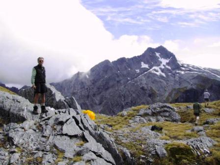
Gillespie Saddle
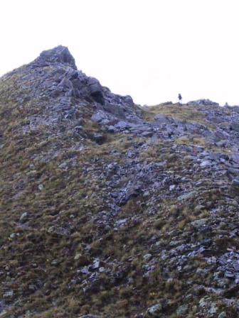
Gillespie Peak
You don’t sleep in too late in an alpine cabin.
Everyone was up and out shortly after 8:00 AM to tackle
the Gillespie Pass. We hiked for 1/2 hour across the
valley and stood looking at the trail leading to the top
of the pass. No easy, but twice as long switchbacks here,
the path led almost straight up the steep slope. Ray
estimated the incline was 60% at times. I had started
from the hut in my raincoat, but it only took five
minutes of climbing to be down to shirtsleeves. We took it easy,
stopping to rest now and then and drinking lots of water.
By 11:00 AM, we joined some of our cabin mates at the top
of the pass (1580 M). The view was superb. The glacier on
Mt Awful spread it tongue of ice down towards us and the
Gillespie Creek snaked along the bottom of the valley on
the other side. We still had a bit of
climbing left before we could start the descent, but that
was easy. The forecast was for rain later in the
afternoon and clouds were gathering over the peaks, so we
hurried down. We stopped to eat our lunch beside the
trail at the edge of the tree line at noon. From there it
was a steep descent through the forest to Gillespie
Creek, then down further to Siberia Creek in a broad
valley. We were warned that the sand flies lived there
and sure enough they were there to greet us. I said at
one time that I thought black flies were worse than sand
flies, but I think it is a draw. We dug out the DEET, but
still ended up with itchy reminders of our visit.
Another 45 minutes of hiking across the valley and we
were at Siberia Hut. It was about 2:30 PM and I just
wanted to sit down and take off my boots. One of our
fellow trampers who arrived before us said there was a
note on the table asking if anyone was interested in
taking a flight back to town rather than walking. I
perked right up. A small plane company in Makarora offers
to take people on the ‘Siberia Experience’. You are flown
to an airstrip near the Siberia Hut, walk out along the
Siberia River for about three hours, then ride a Jet Boat
down the Wilkins River back to Makarora. We had been told
that you could hitch a ride back in the plane for $30. I
was definitely interested, as a scenic flight sounded
more appealing than the Jet boat ride. Liz, the hut
warden, appeared just then and announced that the flight
was coming in at 3:30 PM. She was walking down to meet it
and if anyone wanted to leave on the plane, they should
follow her. I made an instant decision and convinced Ray
we should put our boots back on and walk just a little
further to the airstrip.
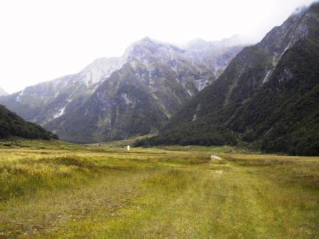
Siberia River runway
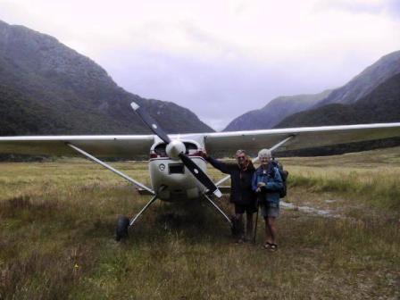
Our plane to take us out
The only thing separating us from the airstrip was the
Siberia River. This was a shallow ford, but I was an
expert now. Both of us changed into our sandals and waded
into the water with our packs on our backs. It only came
up to ankles, but it was as cold as the Atlantic in
spring. Thank goodness it was only a few minutes across. We
joined Liz in the grassy meadow beside the airstrip and
waited for the plane to arrive. Liz is a middle-aged
schoolteacher from Auckland who volunteers as a hut
warden for a month of her Christmas break. She gets a
different hut eac year and loves it. We had plenty of
time to relax and chat for the plane didn’t come. Liz
said this often happened if prospective customers
cancelled, but I was disappointed. There had been no
flights in for two days, probably a reaction of reports
of a small plane crash elsewhere. I knew we could always
stay overnigh and walk out the next day, but those sand
flies at Siberia Hut were not very appealing. At 4:15 PM
we reluctantly forded the Siberia again and slowly got
our boots ready to put on. We were in luck. We were certain
we heard the sounds of an airplane engine and sure
enough, a small white plane came into view and made a
circle around the valley preparing to land. We got our
packs on our backs again and forded the river for the
third time. I didn’t even notice the cold this time.
After the pilot, Steve, saw his three passengers safely
across the Siberia to start their hike, we loaded up and
took off. Steve made another circle past Siberia Hut,
where we could see everyone waving goodbye to us, and we
were off following the rivers down the valley back to
town. It was only a fifteen minute flight, but we were
low enough to get a good view of everything below us. It
was a fitting end to our tramp. We even managed to get
our same cabin back and celebrated with a hot shower and
a glass of wine.
Next:
Episode 5: Page 2 Wanaka to Queenstown
Read about our visits to the
Cook Islands or
Fiji
Return to
New Zealand
Intro
Return to
Travels
Return to
Introduction