Episode 5: Greymouth to Queenstown
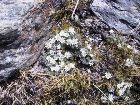
Alpine flowers
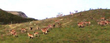
Deer ranch in Maktukituki Valley
Read Previous Episode
Nelson to Arthur’s Pass or Next
Queenstown to Invercargill
Episode 5: Page 2 of 2 Wanaka to Queenstown
Tuesday 29 January
2002, Queenstown NZ
Pancakes, Ice and More Peaks
Continued from Episode 5: Page 1
Greymouth to Makarora
The next day, Friday 25 January, we were off to
Wanaka, a small resort town at the southern end of Lake
Wanaka, which starts just outside Makarora. That meant we
had a pleasant one-hour drive along the shores of the
lake. If these lakes were in North America, they would be
ringed with cottages, but NZ does not have the population
to overcrowd their recreational areas. All we passed were
pastures of sheep and cattle and the occasional farmhouse.
However, we had not realized how popular Wanaka is and
none of the backpacker hostels had a double room
available. Once again, we were lucky. The campgrounds in
NZ often have cabins to rent as well as tent and caravan
sites. The Wanaka Holiday Park, on the edge of town also
had a lodge, set up with backpacker type rooms and all
the facilities under one roof. We were very comfortable
there.
Mountain bike races were been held that weekend in the
hills around Wanaka and several of the contestants were
staying at the same place we were. Ray talked to a young
man who rides for the NZ team and was entered in the
downhill on Saturday. He had been in town all week,
training for the event. We saw him after the race. He
survived, but the tough conditions took its toll on his
bike. He broke his derailleur on a rock and put himself
out of contention. We met another contestant, a young
lady who was racing in the cross-country event on Sunday.
She must be one gutsy lady, as she was missing one hand.
We didn’t stay long enough to hear how she did, but we
wished her good luck before we left.
We had a great day hike on Saturday. Several people on
our Gillespie Pass tramp had recommended we go to see the
Rob Roy Glacier. To reach the trailhead, we drove around
Lake Wanaka and followed a dirt road for 40 K beside
Raspberry Creek in the West Maktukituki Valley. The ride itself
was worth it, with views of Avalanche Glacier and all the
other mountains of Mt Aspiring National Park. You travel
through a huge sheep and cattle station where the
livestock roam at will, kept from straying too far by
cattle guards across the road. There were five streams to
ford before we reached the car park, but luckily none was
deeper than a few inches and Alice didn’t object.
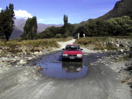
Alice makes it over Maktukituki Ford
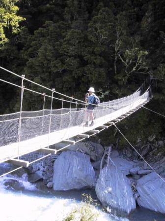
Raspberry Creek bridge
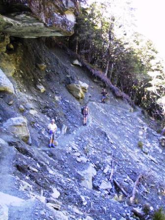
Rob Roy Trail
The trail to reach Rob Roy Glacier was a
gradual uphill climb for 1 1/2 hours through the forest
beside the rushing Rob Roy Creek. Just
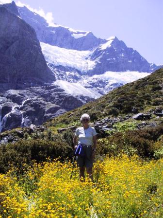
above the tree line we came out to a point to see the
glacier just on the other side of the creek. We got our
lunches out and sat admiring the snowy site. It was huge,
reaching up the valley far above us. Waterfalls, starting
as rivers under the ice, shot out of the sides of the
rock below the glacier, cascading 100 M down to the Rob
Roy Creek. We were not close enough to walk on it, but we
were close enough to hear the thunder of chunks of ice
falling off the glacier somewhere up in the ice fields.
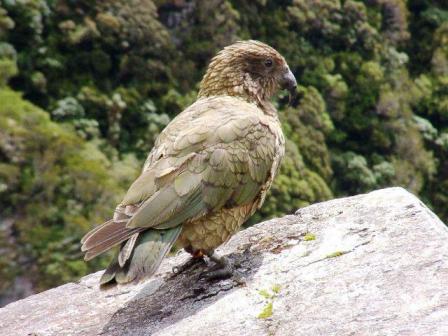
A word
about Keas; these are alpine parrots, about the size of a
large hawk. They are considered a pest for they will
steal anything bright and shiny they spy. We had seen
warnings at each campsite warning tramper not to feed the
Keas, but we had never seen one up close. We had our
chance at the Rob Roy Glacier. As soon as we arrived, the
Keas came to visit. They didn’t just visit, they thought
they were invited for lunch and landed right next to us,
hoping for a handout. They didn’t even budge when we got
our cameras out to take their picture. One young man had
passed us, running up the trail. He was resting near us
with his shoes off and his bright blue T-shirt over his
head, shading his eyes from the sun. One of the Keas
hopped over and tried to steal the T-shirt. Over and over
again, the Kea would gently tug at the T-shirt and the
young man would wave his arm to get him away. When that
didn’t work, the Kea tried to nibble a bare toe. That was
enough to get the young man to finally shoo the bird away.
Kea
view of glacier on Rob Roy trail
After our lunch we decided to hike farther up the
creek to get even closer to the glacier. We followed a
vague trail, bushwhacked through prickly shrubs, and
picked our way across scree for almost an hour until we
were another 300 M higher up. We had an even better view
of the ice fields and heard continual thunder rolls of
cracking ice. On our return down the valley, we refilled
our water supply from the creek. It was deliciously cold
and kept us hydrated all the way back to the car. This
was one of the best one-day walks we have done.
bra collection
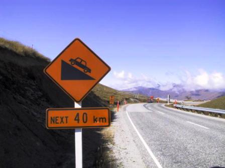
Steep hill up ahead
Sunday was another perfect summer day. We had a
leisurely drive to Queenstown. We took the direct, but
scenic route past Cardrona, a ski field where the
downhill mountain bike races were held the previous day. Just out of Wanaka we stopped
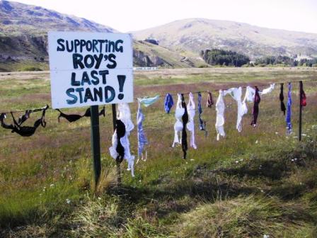
to take pictures of ‘Roy’s Last Stand’. Some wag had
started a collection of women’s bras and there were about
thirty of them strung along a fence beside the road. A
competing collection of men’s underwear did not stand a
chance, as there were only three pairs on display. Just past another
road sign indicating a steep downhill for the next 40 K,
we stopped again to look out over the valleys leading to
Queenstown. The hills we were passing through were much
drier and were mainly treeless, just covered with grass
tussocks or low shrubs. The landscape changes so fast in
this country.
We made a detour to Arrowtown, a nice touristy little
place that started life as a gold mining town. Several of
the original buildings and miner’s cottages have been
restored, but it seemed to be mainly the shopping that
drew the tourists, us included. We managed to find
several items to buy as souvenirs or gifts. We ate our
lunch in a little park in the center of town and
continued on to Queenstown.
Queenstown is a larger version of Wanaka, on a bay at
one corner of Lake Wakatipu. The lake must be about 100 K
long. It is shaped like a Z on its side and surrounded on
all sides by towering, mostly treeless peaks. Queenstown
is the only town of any significance that we could see on
the lake. In fact, the road doesn’t extend all around the
lake and there were hardly any houses to be seen, except
for the area around Queenstown. We learned our lesson in
Wanaka and we had reserved a room at Scallywags hostel.
We are pleased with our choice, especially as it is a
nice quiet location on a hill overlooking the lake on the
west edge of town.
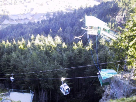 Queenstown’s best view is from the restaurant complex
at the top of the Gondola. A gravel vehicle road, used
mostly by hikers and mountain bikers, started just next
to our hostel and led to the top of the gondola. We
walked up the first evening. There were lots of people
around, like us, getting their picture taken to prove
they had been in Queenstown. Actually, it is an
impressive sight with the craggy peaks of the Remarkable
mountain range and the long blue waters of the lake. Queenstown
is renown for its thrills and chills activities, such as
bungy jumping, parasailing, tandem parachuting, river
rafting or sledding and canyoning. We are not into fear.
A popular activity at the top of the gondola station, is
the Luge. You ride a three- wheeled plastic sled down a
twisty concrete channel, steering with a handle bar that
acts as the brake as well. It looked like fun, so we
decided to give it a try. We had the option of taking the
politely termed ‘Scenic’ or the ‘Advanced’ route, but we
opted for small thrills and chose Scenic. It was fun.
Next time we will be ready for the ‘Advanced’ route.
The Routeburn, one of NZ most famous tramps and it
starts not far from Queenstown. We had read all the
descriptions and because the tramp requires you took take
a long four-hour journey back to the start, we planned to
do the Kepler Tramp instead. As an alternative, we found
out we could drive to the start of the Routeburn and do
part of it as a day hike. Sunday started out with clouds
covering some of the peaks but it quickly developed into
another beautiful day. We drove 44 K to the western end
of Lake Wakatipu, then another 26 K on a gravel road to
the trailhead. We picked up a young couple hitching a
ride with their packs on their back. They had missed the
shuttle to the trailhead. It seems the young have trouble
getting up in the morning. Since they had already
reserved and paid for the tramp, they were hitching. They
were only too glad to accept our offer of a ride.
The first section of the trail was almost too easy. It
was advertised as taking anywhere from 1-1/2 hours to 3
hours to walk to the Flats Hut, the first hut. It took us
only 1-1/2 hours, but all we had to carry was our
daypacks with our lunch and water. The trail had been
upgraded sufficiently to suit several commercial
companies that run guided trips on the route. You have a choice of a day or
an overnight hike and you only have to carry a daypack.
Everything is all flown in by helicopter for you. The
trail ran through a beech forest, beside the Route Burn
stream. It was broad enough for us to walk side by side
for most of the way, and it didn’t have any long climbs.
We had lunch at the Flats Hut, in a grassy valley
surrounded by forested mountains.
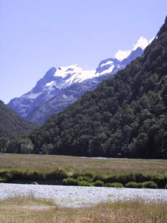
Routeburn flats
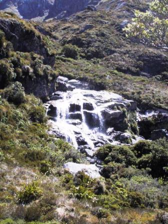
Routeburn waterfalls
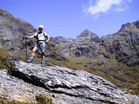
Jeanne on Routeburn
We decided to
carry on up the trail to the Falls Hut. It was a more
interesting walk of an hour with rougher terrain, more
uphills and better views. There were actually two large
huts at this stage on the trail. DOC runs one, with 40
bunks and a private guiding company runs the second. Just
above the Falls Hut we came out of the trees and saw the
namesake waterfalls. They were impressive, splitting into
multiple cascades over the rocks. A little
farther up we got a view of the Harris Saddle leading
into the next valley. It would have taken another hour to
reach the saddle and thinking of our return trip, we
decided we had gone far enough. Maybe another year we
will do the Routeburn all the way. Anyway, it was another
great one-day hike.
Today, Tuesday, we are finishing up our chores in
preparation for moving on. We have come to the point in
our trip where we have to plot out our days and decide
what we must eliminate from our itinerary. I can’t
believe we only have a month left. Where does the time
go? Tomorrow we drive to Milford Sound, where we will
take an overnight cruise in the fjords. Then we will do
the Kepler Tramp in three days. We are looking forward to
both trips. You will hear more of them in the next
Episode.
Back to
Episode 5: Page 1 Greymouth to Makarora
Read about our visits to the
Cook Islands or
Fiji
Return to
New Zealand
Intro
Return to
Travels
Return to
Introduction