Episode 7: Catlins to Christchurch
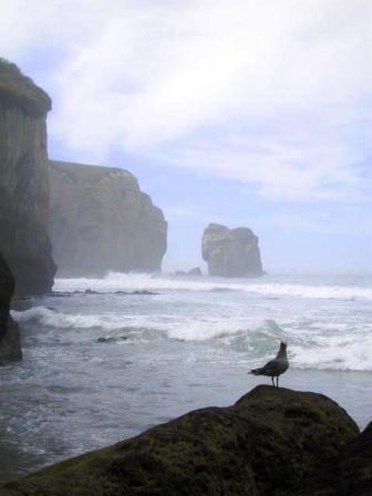
View from Tunnel Beach
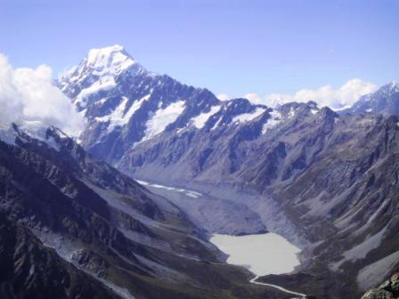
Mt Cook and Hooker Glacier
Read Previous Episode
Queenstown to Invercargill
Episode 7: Page 1 of 2 Catlins to Mt Cook
Wednesday 27
February 2002, Christchurch NZ
Wild Things and Farewells
Skip to Episode 7:
Page 2 Mt Somers to Christchurch
Yes, we are at the end of our
trip. It doesn’t seem possible but we will soon be back
in wintry Canada. I can’t say we have had an especially
warm and sunny Kiwi summer, but there have been enough
good days for us to accomplish nearly everything we
wanted to.
We bid a fond farewell to Alice. She served us well
and we made sure she went to a good home. We managed to
sell her within 24 hours of arriving in Christchurch, so
I guess we were lucky. There were many other
advertisements for backpacker cars for sale. Alice is now
exploring new locales and reliving familiar ones with her
new owners, two young Israeli girls.
But back to our adventures. The last you heard from us
I was moaning about not seeing any penguins. You will be
glad to hear that they do exist in NZ. We finally got to
see the little critters after one more false promise.
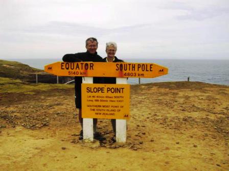
Most Southerly Point of NZ South
Island
We took the scenic route from
Invercargill along the south coast of NZ. Just to say we
had done it, we stopped en route to walk to Slope Point,
the most southerly point on the South Island. It is kind
of like visiting Land’s End in England. Now we can say we
have been from the north to the south in NZ.
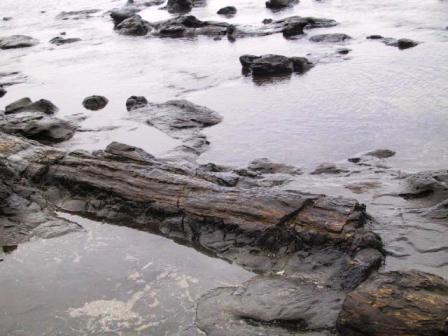
Remains of Petrified Forest
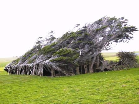
Permanently Windswept Trees
Just a little farther up the road is Curio Bay. We
walked down a cliff path to the
beach where there are the remains of a petrified forest.
There were big chunks of tree stumps and fallen logs
strewn along the beach. This gives proof to the theory
that the South Island was once joined to Stewart Island
58 Km to the south. Right next to the petrified forest
was a rocky shelf that is the landing spot for the Yellow-eyed
Penguins, but there were none to be seen. We left
disappointed again, but just around the corner, we were
in for a treat. About a dozen Hector’s Dolphins were
frolicking in the aptly named Porpoise Bay. There were
notices at the beach instructing people how to swim with
the dolphins (you don’t approach them, you let them come
to you). It sounded like fun but the day was windy and
cold and I don’t have a wet suit. We contented ourselves
with watching them from the shore as they bounded along
the surf.
That night we stayed in a very nice backpacker’s in
the tiny village of Owaka, still in the Catlins. The
owners have put a lot of time and effort into restoring
and decorating an old three-bedroom cottage. A Kiwi-German
family arrived after driving from Dunedin. They told us
they had just come from Nugget Point, about a half hour
away, where they had been watching the Yellow-eyed
Penguins come ashore. Apparently they wait until late
afternoon or early evening to come ashore. We didn’t need
any more encouragement. It was already 7:00 PM but we
were out of there like a shot, driving down a typical
Kiwi dirt road to see those little devils. The Department
of Conservation (DOC) has build a small wooden cabin as a
blind to watch the penguins without disturbing them. It
was great. The penguins swim to shore through pounding
surf, landing on a rocky shore at the base of a steep
hill. The penguins would stop at the water’s edge for a
rest, preening and wiggling to dry off before doing their
Charlie Chaplin walk over the beach to the hill. From
there, they would hop from rock to rock, making their way
up the hill to their nests in holes on the side of the
hill. They live in a colony but they like their own space
for their nests, so they are willing to travel long
distances to find just the right spot. We watched
transfixed as one penguin after another landed and
started their long climb. Some rushed right up the hill
while others were still resting at the bottom of the hill
when we finally left.
There was even more wildlife to see at Nugget Point. We drove farther up the point
and walked along a path to a godforsaken rocky point 100
M above the ocean. This is the site of one of the
earliest lighthouses in the area. Opened in 1870, it is
still working, but automatically. Far below us was a
colony of fur seals lounging on the rocks. We laughed to
see a few of them using a small pool as their private spa.
They are amazingly graceful in the water, putting the
best synchronized swimmers to shame. We had a late dinner
that night, but it was worth the wait.
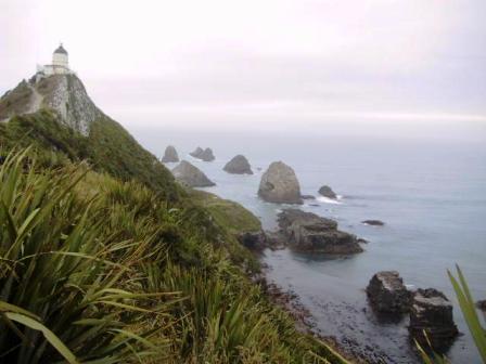
Nugget Point
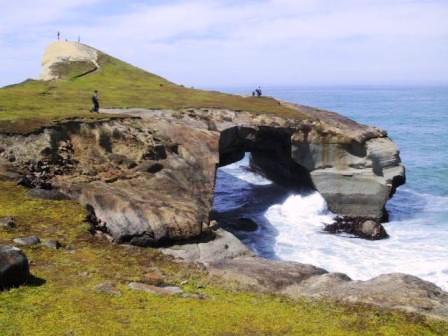
Natural Arch at Tunnel Beach
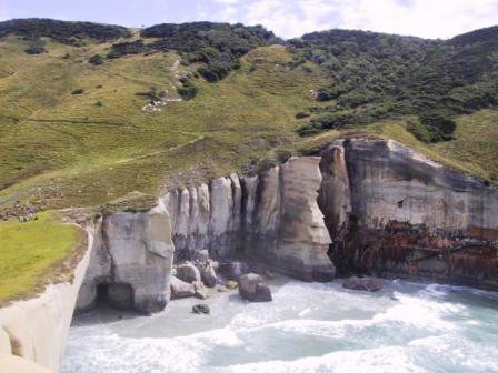
Cliffs at Tunnel Beach
The next day we
continued on to Dunedin. We stopped for a picnic lunch at
Tunnel Beach. A previous landowner, John Cargill, wanted
his family to have access to a small beach at the base of
high limestone cliffs. He manually dug a
20 M long tunnel, complete with stone steps, through a
cliff to provide access. There is just enough beach to
swim or have a picnic at low tide. When you finish
swimming you can go back through the tunnel and walk on
top of the cliffs and admire a huge stone arch formed by
the wave action.
We arrived to cold, rainy weather in Dunedin. We tried
to follow a self-guided tour of the historic downtown
area, but the rain drove into some shops instead. It was
an expensive but rewarding walk for me. We took advantage
of the rain in the afternoon to have some down time until
the weather improved. I spent most of the afternoon
finishing the sweater I was knitting while Ray read his
book.
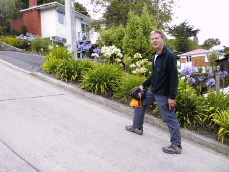
Baldwin St, world’s steepest street
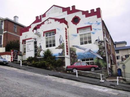
Dunedin Backpackers on second steepest
street
Dunedin boasts
Baldwin St, the world’s steepest street, with a grade of
1:2.86 at its steepest spot.When the weather
cleared we walked up it. It lived up to its reputation,
but I think our backpacker’s hostel was on the second
steepest street. Little View St was just a block away
from the Octagon in center of Dunedin. We had a tiny
parking spot next to the hostel. Ray said that he was
afraid the car was going to tip over when he parked there.
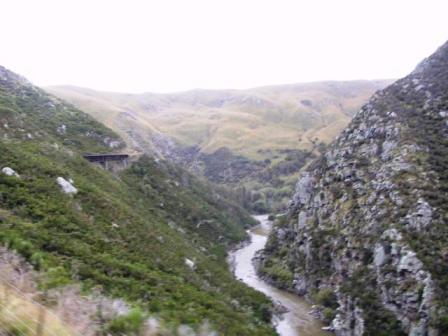
Taieri Gorge
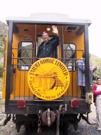
A trip on the Taieri Gorge Railway sounded like a good
activity for less than perfect weather, and it was. The railway was built by hand
through an impossibly steep gorge from 1879-1889 to open
the interior country to farming. By 1921 it covered 235
Km from Dunedin to Cromwell, near Queenstown. Like our
North American railways, it gradually became uneconomic
to run and was finally shut down in 1990. The
City of Dunedin became a major stock holder in a company
that decided to run the train as a tourist attraction and
is making a good profit from the operation. The four hour
return trip climbs 58 Km up the gorge, then at the end of
the track, the engine shuttles from the front to the rear
of the train and pulls the train back down the valley. It
was a most pleasant trip with photo-op stops along the
way. There was even time to order afternoon tea to be
delivered to your seat. Decadence plus.
The Otago Peninsula is right next to Dunedin. It
boasts a scenic drive along the coastline and an
Albatross Center at Tairua Head overlooking the mouth of
Otago Bay. Royal Albatross started coming to the head to
nest between 1914-1919, but they were not protected until
1937. The Albatross Center, established in 1972, is a
privately run operation under the sanction of DOC.
We made it out to the center in time to join a 2:30 PM
tour. We all trooped into a lecture room to learn about
the Royal Albatross, which must be one of the largest
birds in the world. Found only in the Southern
Hemisphere, it has a wingspan of 3 M and does not really
fly, but glides low over the ocean. Its wings lock into
place allowing the bird to use the updraft from the wave
troughs to move it along almost effortlessly. They have
been known to cover as much 6,000 Km in a few days at
speeds up to 100 Km/Hr. After the instructive talk, we
walked up to an observation house at the top of the
cliffs. From there we could see about six nests, each
with an Albatross perched atop a baby chick. One parent
at a time guards the chick while the other is off for as
long as two weeks searching for food. We were told that
the Albatross need strong winds to return to land and
since it was a relatively calm day, we might not see much
flying. We were in luck. As we watched, one Albatross
came soaring into view, circling the cliff top. It was
the oldest female in the colony, at 41 years, returning
to her second mate, a 16-year old (a toy boy?), who was
babysitting. It was fascinating to see her land and go
through a ‘Hello Honey’ routine, just like the Gannets we
had seen near Napier. The fluffy, white chick got into
the act too, peering out from beneath its father and
flapping its wings. We were sorry to leave, but the next
group of tourists was at the door.
After leaving the center, we spent more time walking
along the paths bordering the cliffs, watching the other
birds in the area. The real bonus was seeing at least two
other birds soaring around the complex right over our
heads. It was probably Dad preparing to go out to sea and
one of the resident adolescent birds practising its
flight, but the sight was impressive. They are so large
and graceful.
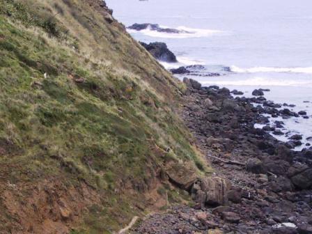
We took a different route back to town along the
opposite shore of the peninsula. I had heard that Sandfly
Bay was a possible Yellow-eyed penguin landing spot, so
that is where we headed. We drove as far as we could
along a dirt road, then parked and headed across sheep
pastures to sand dunes we could see in the distance. It
was supposed to be a half hour walk but we managed to
explore new territory (i.e. we couldn’t find the trail
markers) and it took us about an hour to reach the dunes
and then the beach. It just looked like a long sandy
beach and we almost gave up and went home. We didn’t,
thank goodness. At the
end of the beach we came to a sign directing us to a
penguin Viewing Hide. As soon as we got inside, we looked
out to see a yellow-eyed penguin resting on top of a rock
just at the sea edge. Soon, another penguin swam into the
bay and climbed ashore. The second penguin wasted no time
climbing up the rocks and up a path to the top of the
hill. Some movement in the grass half way up the hill
alerted us to two young penguins coming out to greet the
new arrival. I guess they thought it was Mom returning
home, but they were disappointed. Mom kept going higher
still until she was about 50 M above the sea, where she
found her own chick. We heard a terrible squawking near
the Hide and looked out to see two more young penguins
just a few feet away. They must have been telling their
parents to hurry up with dinner. Soon it was time for us
to leave, reluctantly, but we did find a more direct way
back to the car.
Sandfly Beach
Moeraki Rocks
Even Ray can’t move the rock
The next day we drove farther
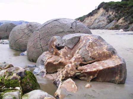
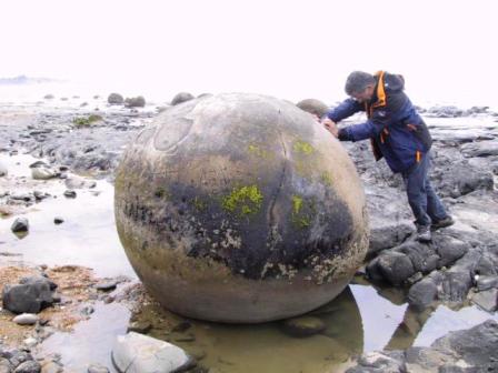
north to Oamaru. We stopped for lunch at the Moeraki
rocks. They really are strange looking. The beach is
strewn with giant bowling balls about four or five feet
in diameter. They were formed millions of years ago in
the mud cliffs at the edge of the beach. The rocks formed
by chrystallizing equally around a nucleus, creating a
perfect ball. As they dried, they cracked
and the crevices were filled with calcites, which
hardened in turn into crystal veins. The result is a huge
sphere with veining like to a turtle’s shell. All the
tourist buses stop here to have a look but it is worth
while seeing.
The manager of our backpacker’s in Oamaru was quite a
character. He has two hobbies. He makes and sells Penny
farthing bicycles and participates in an annual race in
Oamaru. In addition, he is a member of an historic
militia group that dress in the uniforms of a hundred
years ago. That weekend his group was travelling to
Christchurch to do battle with a Chinese community
regiment. Since they are a pacifist regiment, the weapons
were to be jello, chocolate pudding and spaghetti. Three
Israeli backpackers who had stayed at the hostel
previously were so taken with the idea that they were
going along as participants. Sounds like more fun than
many other hobbies.
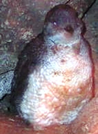
The real reason we came to Oamaru was to see more
penguins. There is a large colony of Blue penguins, the
smallest variety, just on the edge of town. A private
organization has taken over the protection of the colony
and built nesting boxes in a small field for the birds.
The penguins climb up a rocky cliff, cross a gravel road
to reach their nests. They have cordonded off the area
and built viewing stands for tourists to come and watch
the birds come ashore. The Blue penguins are later
arrivals than the Yellow-eyed penguins. They wait until
dark to make their landings. By the time we arrived for
the nightly ritual, there were already scores of people
assembled. I couldn’t believe the penguins would still
come ashore with so many people watching them. They must
be quite used to the attention by now for come in they
did. Right on cue, the birds fought their way through the
very high surf and made their way up the rocky cliff. One
penguin got swept onto an old cement loading ramp. He
waddled up to the top, right next to a fence where
everyone was standing, and sat down to wait everyone out.
I thought he looked rather lost, but one of the guides
told me he is a show off and lands there every night.
Meanwhile, there was a lot of squawking from the waiting
chicks in their nests in the field. Soon there were
several little penguins scuttling across the path in
front of the viewing stands and hurrying to their nests.
The one thing
that is forbidden is to take flash photographs of the
penguins as it scares them. I made sure the flash was off
on my camera and took a few pictures. Then I tried a
‘nighttime’ setting and to my surprise, the flash went
off. There was a collective ‘ah’ from the crowd. I was
glad it was dark and I could sneak away undetected. Thank
goodness it didn’t really seem to bother the penguins at
all.
Blue Penguin
The next day we
took off to see Mt Cook National Park. There are 27 peaks
in NZ over 3050M and 22 of them are in this park,
including Mt Cook itself. At 3755 M it is the highest
mountain in NZ. More than one-third of the park is in
permanent snow and glacial ice. We stopped a few times on
the road leading into Mt Cook village just to take
pictures of the awesome sight of the glaciers and the
mountain peaks.
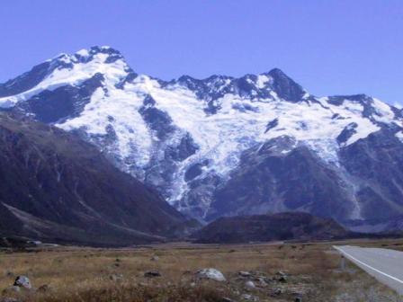
Huddleston Mountain, Mt Cook
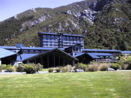
Hermitage Hotel
Mt Cook village as you might expect, exists solely for
the tourists who come to see the mountains and
Conservation people who try to protect the area. The
choice of accommodation is the very expensive Hermitage
Hotel, some rental cottages or the Youth Hostel. The Hermitage
recently bought out and closed the only other reasonably
priced accommodation. That means it is a sellers market.
We paid on average $40 for a double room in NZ, and the $68
charged for a double room in the YHA was the highest rate
we paid for our entire trip. At least it was a
comfortable and well-run establishment and we loved Mt
Cook.
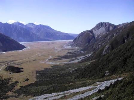
View down to Mt Cook Village
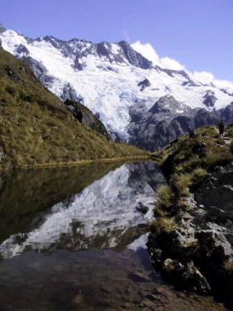
Sealy Tarn
The
day after we arrived, we packed our backpacks and hiked
up to Mueller Hut. You can make the trip up and back in
the same day, but we had been advised to stay overnight
to truly appreciate the area. We fully agree. The walk up
was almost three hours of steep walking, but the views
made it worth while. It was a hot sunny day and we
were treated to the sight and sounds of parts of the
glaciers across a narrow valley from us breaking off and
cascading down the mountain. Halfway up the trail are the
Sealy Tarns, small glacial ponds. A few of the trampers
jumped in for a swim to cool off, but it didn’t look
quite inviting enough for me.
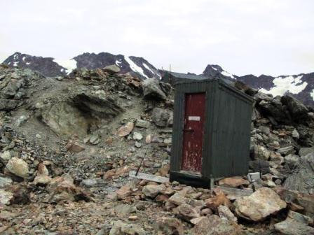
Mueller Hut outhouse
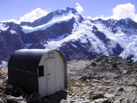
Mt Cook Warden’s Hut
Mueller Hut, at 1800 M, was perched on
the top of those big, jagged rocks we had encountered on
several of our other alpine walks. You wonder how they
ever made enough level ground to build the hut. It was
quite breezy when we arrived, so we found a sheltered
spot in the rocks for our picnic lunch. Ray had left my
cotton scarf I use for a brow mop on the ground beside
him. Suddenly, a large gust of wind took the scarf into
the air and whirled it around in higher and higher
circles. I though it was lost, but luckily the wind, just
as capriciously, dropped it right on the edge of a
precipitous drop. I quickly retrieved it before it went
on another trip.
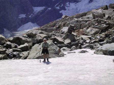
Mt Cook Snowfield
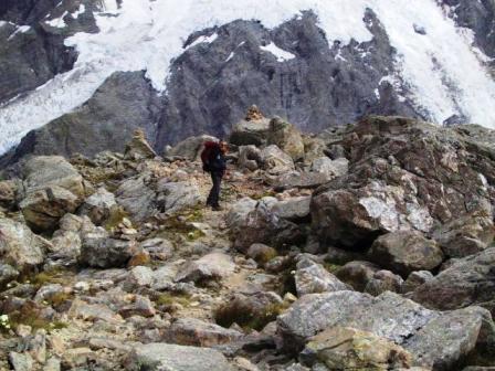
Mueller Trail
Mt Ollivier, a
small rocky peak right next to Mueller Hut made a good
afternoon excursion. We boulder hopped our way up to some
rock cairns marking the high point of the peak at 1920M.
We could see another cairn on another peak not far away,
but the route seemed to be down to a saddle and up a
steep pitch. We decided we didn’t need to bag another
peak. Instead we took an alternate route back. There were
no cairns or markers in sight so we just headed in the
right direction. We picked our way
down the steep slope over loose scree and walked across a
small snowfield before finding some trail markers
indicating we were on the right path.
The next day there were some clouds over the highest
peaks, but the weather
was still fine for our descent. We made it back to our
car in two hours. Going down is much easier. We stayed
another night in Mt Cook village just relaxing and
enjoying ourselves. We walked over to the Hermitage and
had tea and cake on their balcony overlooking Mt Cook.
Ray says he looks forward to returning to this area
another time and exploring more territory.
Next:
Episode 7: Page 2
Mt Somers to Christchurch
Read about our visits to the
Cook Islands or
Fiji
Return to
New Zealand
Intro
Return to
Travels
Return to
Introduction