Episode 4: Nelson to Arthur’s Pass
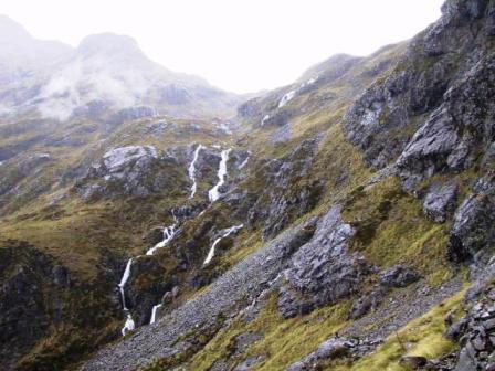
Cascade Trail
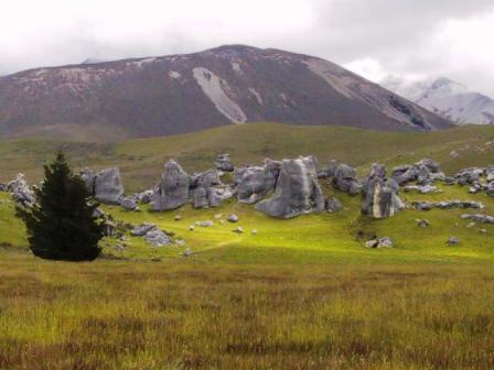
Castle Hill on Arthur’s Pass Road
Read Previous Episode
Rotorua Hikes to Havelock or Next
Greymouth to Queenstown
Thursday 17
January 2002, Arthur’s Pass NZ
Peak Experiences and Seal Encounters of the Close KindYes,
we are still on the road and sampling all that NZ has to
offer. We are doing our best to fit everything in but the
weather and time dictate that a few experiences must be
left to another visit.
The sun was actually shining when we arrived in
Nelson, but it didn’t stay long enough for us to visit
one of the nearby beaches. Instead, we went to the WOW
museum. What is WOW you say? It stands for World of
WearableArt and is an incredible two-part collection of
Costumes and Collectible Cars that several other
backpackers had recommended to us. It was a hoot. The
Nelson area is host every year to a competition of
Wearable Art, a combination of Halloween costumes, Mardi
Gras outfits, and someone’s wild imagination. The
exhibition had film footage of the contests where models
are hired to wear these outrageous outfits. Some are so
large that they have an undercarriage with wheels to
propel the costume along. Of course they are accompanied
by wild music and light and smoke shows. The costumes are
made of everything from recycled pull tabs from cans,
plastic wine bags, painted fabric, shells, feathers,
papier mache, hair, electrical wire and anything else you
could name. The costumes were displayed in the museum on
mannequins that hung from the ceiling, stood on the floor
or twirled by on a moving platform lit by coloured
spotlights.
The cars were displayed equally imaginatively in a
large showroom next to the Wearable Art rooms. Several
more mannequins in costumes suitable for the era of the
car were posed alongside the cars. A few roadsters had
video screens inside playing snippets of old movies that
featured that particular model. A 50s Chevy was displayed
next to a drive-in soda shop with a waitress on roller
shakes and Peggy Sue playing from the car radio.
Reluctantly we left WOW and drove off to the Nelson
Lakes where we had reserved a room at the Yellow House
Backpackers in the village of St Arnaud. We hoped to do
an overnight tramp in the area so our first visit was to
the local Department of Conservation (DOC) office. They
were not very encouraging about the weather so we decided
to wait an extra day hoping the rain would move on.
A special Family Concert was advertised for that night
at the local interpretive center, so we hurried through
our dinner in order to attend. The children of seven
local families have been studying the violin and other
instruments under the Suzuki method. They had just
completed a summer camp and this was their recital night.
They were remarkably good. About 10 children, aged 10 to
18 played several violin sonatas together. We had piano
and voice solos and trios demonstrated their talent on a
wooden xylophone. To finish up the program, a string
quartet that has won several NZ competitions, played for
us. A few kiwis have told us that the Arts are not very
well regarded in NZ, but it is groups like this that will
keep the interest up.
The advertised rain started later that night and
continued off and on all day. We took the opportunity of
a day off to visit the nearby lakes and towns. St Arnaud
is next to Lake Rotoiti. This is a popular fishing lake,
about two K long, surrounded by forest covered hills
descending to the water’s edge. Both Lake Rotoiti and the
nearby Lake Rotoroa are bases for many long walks to the
mountain ranges surrounding them. Neither lake has very
many cottages or ‘baches’ around them and there are few
motels or hotels to stay in, so they are very quiet and
unspoiled places. Even Murchison, the largest town in the
area, is pretty tiny, but I managed to find some nice
craft and gift shops to pick up some souvenirs.
We woke up the next day, Thursday 10 Jan, to almost
clear skies, so we were on our way to tramp. Our plan was
to skip a three hour hike around the lake by taking a 10
minute boat taxi ride to the end of Lake Rotoiti, then
follow the Cascade Trail to Angelus Hut. We would stay
two nights in the hut to do day hikes around the area,
then walk out on Robert’s Ridge on the third day. It all
worked as planned, despite a little rain to let us know
we were in NZ.
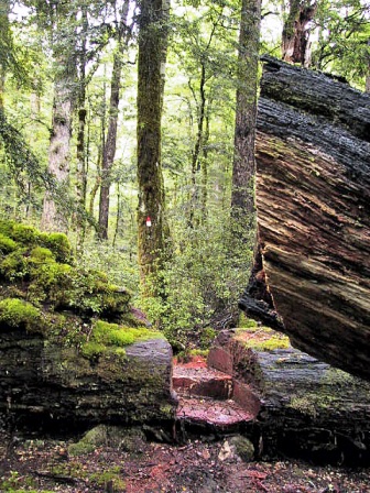
Step cut in fallen tree on Cascade
Trail
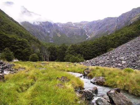
Hukere Stream
 A rain shower stopped by the time the
boat taxi let us off at a small hut about 10 AM. We had
clear skies for the rest of the morning as we followed
the cascading Hukere Stream through a forest path that
climbed steadily up the mountain. It started to rain
gently just as we were stopping for lunch, so we got our
rain jackets out and wore them the rest of the way. We
came out of the woods into a broad meadow surrounded by mountains
with waterfalls cascading down their sides and lines of
scree marking the gullies between the hills. We had been
warned that the last hour was straight up, so we knew the
steep slope on the opposite side of the valley was where
we were headed. The route proved to be 500 M straight up
above the tree line. Of course it was at this time that
the rain got worse. We did have time to stop and take
some pictures before the clouds descended and obscured
the view. Near the top Ray thought it was almost like
sleet. We were very happy to reach the top about 3 PM and
find Angelus Hut just around the corner. Smoke was coming
out of the chimney, so we knew we could get warm and dry
pretty soon.
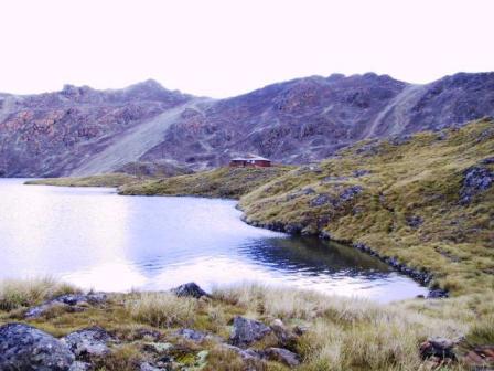
Angelus Hut, at 1650 M, is in a beautiful location,
next to a green glacial lake in a cirque of 100 M high hills. The hut
sleeps 26 people in bunk beds. There were about 20 people
there the first night but only eleven the second, so it
was not crowded. There were mattresses on the bunks, cold
running water and heat from a small coal stove, but you
have to bring your own stoves to cook on. We left our
jackets and boots in the vestibule and once we were
changed into dry clothes, added our wet clothing to the
lines strung over the coal stove.
We were very interested to meet the hut warden, Robin,
a woman about my age, who is a retired NZ Army Major.
This is the fourth year that she has been hired by DOC
for the twelve summer weeks at Angelus. Her husband, also
a keen tramper, is usually with her as a volunteer, but
he was back at their home outside St Arnaud when we were
there. She hikes in every Tuesday morning and out on
Saturday and believe me, you would have a hard time
keeping up to her on the trails.
Angelus Peak
View from Angelus Peak
Robin’s 8:45 weather forecast called for a mainly
clear day Friday, but Saturday, when we planned to hike
out was not so promising. We decided to take our chances
and stay. We said goodbye to everybody else and set off on
our exploration of the valley. We planned to climb to the
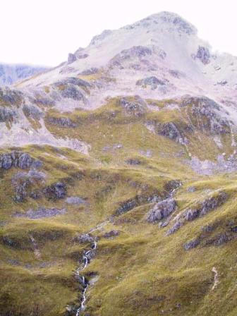
top of Mt Angelus, at one end of the lake. Robin had
given us directions and warned that the trail was not
well marked all the way, but any route would take us to
the top. We took her word for it and promptly missed the
turnoff to the peak. Of well, we had the opportunity to
explore more of the ridges surrounding the lake and to
see the view into the next valley. Eventually we made our
way back to Mt Angelus. This was not the easiest walking
we have ever done. The hills were covered in rocks of all
sizes, from scree to big, sharp boulders. This area was
formed by the action of receding glaciers, as are many of
the mountains at home. The difference is the rocks around
Angelus are not hard granite, they are crumbly, sharp
schist, so we were continually scrambling over
the debris. We did get pretty good at it in time. We
found a cairn marked path from time to time but we kept
losing it and just aimed for the top instead. The last
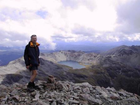
100 M was steep and covered with scree, but we made it to
the top (2070 M), just as the clouds that hung around the
peaks in the morning cleared out. We had a gorgeous 360
view with Lake Rotoroa in the west, Lake Angelus and the
hut far below us and more mountains than we could count
all around us. Someone had built a stone windbreak at the
top, the perfect place to have our lunch. We stayed and
relaxed for quite a while before starting down again. It
started to sprinkle before we could get back to the hut
but what can you expect in NZ! We were pleased with our
day anyway.
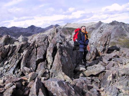
Roberts Ridge Trail
We stayed lucky the next day. According
to Ray’s thermometer, it was 13 C inside the hut in the
morning, but it wasn’t raining. We wore our jackets,
gloves, and toques to start our hike back out but it
didn’t take too long for us to warm up. To start off, we
had to climb 100 M straight up to the top of the ridge.
Thank goodness, that was the only climb of significance
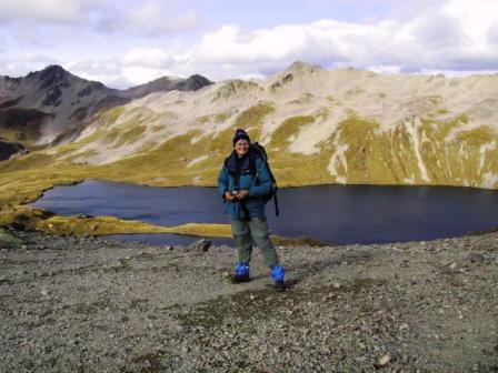
for the day. Robert’s Ridge is about a five hour walk
along an exposed ridge
with great views in all directions. The wind was up, as
it often is there, but we were never in any real danger.
You just had to make sure that your pack was facing the
hill whenever a gust of wind hit you. We had started at 8:30
in the morning and just after 11 AM the trail looked down
into the Mt Robert ski field in another bowl. It was here
that Robin caught up to us. She had planned to leave at 9:30,
so she was really moving.
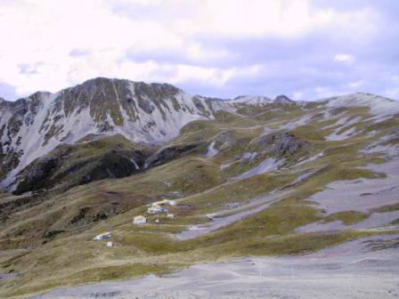 We found out
later that the ski field is privately owned. There is no
road into the area, so the keen skiers have to hike up
the hill for about 2 hours to reach the top of the bowl.
There are a few cabins to stay in at the base of the bowl.
There were just two old-fashioned Poma tows that we could
see to take you up the hill again. You have to be a
dedicated backcountry skier to go there.
We stopped for lunch in the sun outside one of the
small shelters at the top of the ski field, then walked
down, following a switch-backed trail through beech woods
for more than an hour to the parking lot below. We were
picked up by the local shuttle service and had just
started down the road to town when our driver stopped to
see why two 4WD drive vehicles were parked on narrow road.
She recognized the people peering down over the side of
the road and asked them what was going on. It seems they
had been called to try to see how they could retrieve a
truck that had slipped over the side and lay on its side
about 2 M below. It looked as if the truck had come to
close to the soft edge when passing another vehicle on
the road. Thank goodness no one was injured, but our
driver was not pleased as she drives up the road with
passengers several times a day.
Sunday we left Nelson Lakes and backtracked to
Havelock. We had experienced a senior moment at the
hostel in Havelock. The manager had suggested we leave
our passports and airline tickets in the safe when we
were out kayaking and no one had remembered them when we
left. Oh well. We altered our plans to head for
Kaikoura on the east coast, instead of heading directly
for the west coast and got to explore an area that we
were going to skip. It was only 1 1/2 hours to Havelock,
then we were on our way again. We passed through the wine
district of Renwick and Blenheim and this time we stopped
at one of the wineries. We visited the very pretty Wairoa
River Winery and after tasting several of their whites,
bought a Chardonnay that went very well with supper that
night.
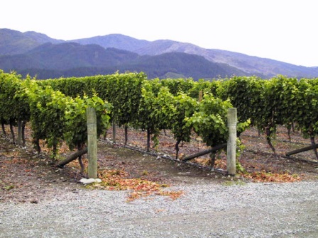
Wairoa River Winery
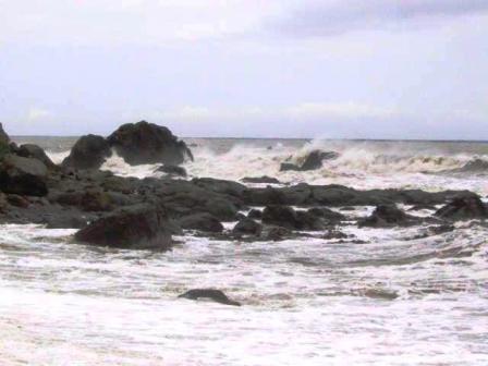
Coast to Kaikoura
We are continually surprised how quickly the
topography changes in NZ. From the green vineyards of Blenheim
we climbed through almost desert like hills to the wild,
rocky east coast. The beaches were black volcanic sand,
interspersed with rocky outcrops, with high waves
pounding against the shore. Seals were lazing about on
some of the rocky points. We had started in St Arnaud in
drizzle, come into sunshine in Havelock that continued
past Blenheim, them ran into the rain clouds again near
Kaikoura. You have to be prepared for every sort of
weather this year.
In Kaikoura we stayed at a small backpackers with just
six rooms and no dorms. It is nice to have a smaller
group of people to interact with. You are more likely to
talk and find out about their lives and travel
experiences.
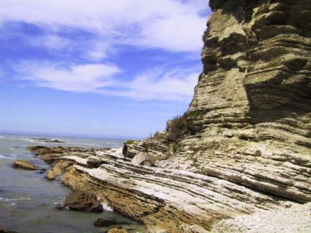
Kaikoura Rocks
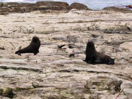
Kairkoura seals
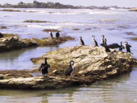
Shags on Kaikoura shore
We picked a good day to be in Kaikoura, for Monday was
bright and sunny. We wanted to explore the local seal
colony by taking the hiking trails around a peninsula at
the edge of town. You have a choice
of following a trail at the top of the cliffs around the
peninsula or at low tide, following the beach route. We
had a few hours until low tide so we opted for the hill
route first. The peninsula shore was a series of beaches
and small rocky points so the hill route gave us great
views of the shoreline. We stopped a few times to see the
seals laze about on the rocky points below us. We had a
choice of going down to the beach half way around but we
continued all the way to the south shore before
descending to the beach. We walked along
the first beach and rounded the point, heading for the
water’s edge. A loud bark startled both of us. It was a
large seal, camouflaged in the seaweed, warning us that
we had come too close. I had read several warning signs
telling you to stay about five meters away from the seals
and not to come between them and their escape route to
the sea, so we in the wrong on both counts. We quickly
changed course and headed for the high side of the beach,
giving the seal a wide berth. This didn’t solve our
problem for long as we soon realized this was a favourite
sun spot for the seals. They were all over the place. We
decided to talk very loudly as we walked along so the
seals wouldn’t be as spooked by our presence as we were
of them. Ray picked up a sturdy stick and carried it with
him. I’m not sure what he intended to do with it but I
didn’t want to find out. Two high rock outcrops guarded
the entrance to another bay. We were going to walk
between them until we saw all the seals right in our
intended path. We decided a detour through the grasses at
the edge of the beach looked like a better route. In the
next bay we walked on either side of a tree trunk washed
up on the shore. You can imagine
how fast we both moved when a seal barked at us from
under the log. We were both rather relieved when we
finally got half way back around the peninsula where the
path we had seen on the top came down to the beach. There
weren’t many seals near the shore from then on, just gull
and shag bird colonies to explore. We hadn’t expected to
encounter the seals so close up, but it was an
interesting experience.
My sister-in-law Carolyn had asked me if we had seen
many sheep. They are just such a common sight I had not
realized I had not spoken of them. They say that there
are 10 sheep for each person in NZ and I believe it. They
are on every hillside and in every field we pass. On our
day waiting for the rain to stop in St Arnaud, I had
stopped several times to take some photos of sheep that
happened to be close to the road. I didn’t have much luck
as mostly I just succeeded in stampeding them to the far
side of the paddock. This got me thinking of wool and
knitting, so in Kaikoura I bought some yarn and a pattern
and I am now knitting away as we drive from place to
place. I got a simple pattern so I can still read maps
for Ray and enjoy the countryside.
Our next destination was Arthur’s Pass over the
Southern Alps, half way between the east and west coasts.
There were supposed to be lots of good tramps in that
area. We made a reservation at Mountain House, one of the
few places to stay in the area and one of the nicest
backpackers we have stayed in. It is managed by two
Canadians, Jan from Sudbury and Bob from Calgary. We
arrived Tuesday afternoon and were assigned a room in one
of their cottages. These are renovated railroad workers
houses on a hill above the main road. Each cottage was
nicely decorated and had three bedrooms that shared
washrooms, a kitchen, a dining area, and a great living
room with an airtight fireplace. Our bedroom had a single
bed and a bunk bed with a double on the bottom. This
meant the rooms could be rented out as doubles, twins or
a four bed dorm. We put on the fire each evening and
stayed cozy and warm.
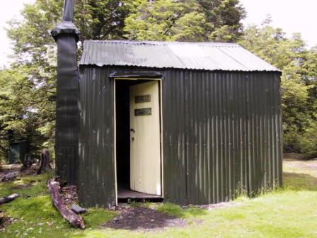
Bealey Spur Hut
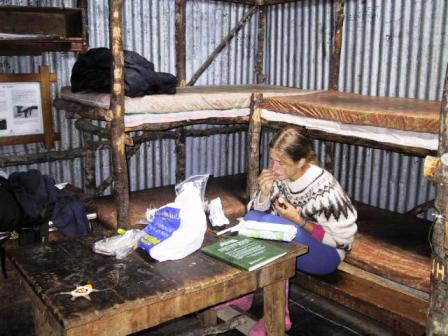
Inside Bealey Hut
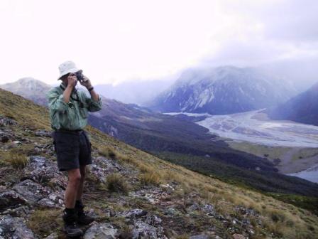
View from Bealey Spur
The local DOC office was not very encouraging about
the condition of the trails for multi-day walks. We are
not very keen on fording streams that mean you get wet up
to your thighs, so we opted to take day walks. There were
plenty to choose from. Wednesday the weather was coming
from the west, so Jan suggested we head a little east and
walk up the Bealey Spur trail. That was a good choice.
While the village (really a settlement) of Arthur’s Pass
got rain showers, we had blue skies most of the day. We had a good hike of under two hours
through beech forest uphill to the Bealey Spur Hut. This
tiny cabin was built in 1925 to house shepherds during
the annual mustering of sheep. It is now run by DOC, but
still has six bunks and an open fireplace. The only
renovations that you would notice were foam mattresses on
the beds. We could see a hill top past an open tussock
field above the cabin and it was too early for lunch, so
up we went. A path led us to an open ridge marked by a few rock cairns
with a great view over the Waimakiriri river spreading to
the east and west, as well as the lines of mountains in
all directions. Some of the peaks had snow fields on top.
We could see the Tranz Alpine express below, a popular
tourist train, that runs from Christchurch on the east
coast to Greymouth on the west. By the time we retraced
our path to the car park we had been out almost five
hours. It was a good day.
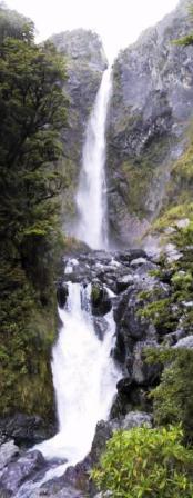
Devil’s Punchbowl Pan
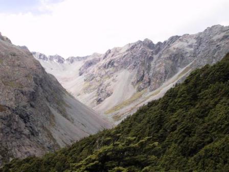
view from Mt Aicken
We had decided to stay another day but the weather was
raining and awful again when we got up the next day. We
just lazed around for the morning, but decided we had to
get out for at least a short walk in the
afternoon. We were in luck. The skies cleared for us. We
headed for the Devil’s Punchbowl waterfalls in town. It
was an easy half hour walk to the base of the waterfalls
that fell 131 M to a small pool before cascading the rest
of the way down the valley. They were very impressive,
but the day was so nice that we went exploring another
trail leading off from the Devil’s Punchbowl. We tend to
like views and that means climbing hills. We found this
on the Mt Aicken trail. We scrambled up the steep hill,
over tree roots and rocky outcrops,
to finally come out on a grassy meadow looking back over
the town. A young couple arrived from farther up and told
us that the rest of the way was not as steep as what we
had come up so we took their word for it. I don’t know
what trail they had been, but I’m glad the view was worth
the effort. We could see across to all the snowy peaks
and back into a rocky box canyon. The area is truly
breath taking.
Yes, the weather does seem to be improving at last. We
leave for Greymouth on the West Coast tomorrow, Friday
Jan 18. Stay tuned for more of New Zealand impressions.
Read about our visits to the Cook Islands or Fiji
Return to New Zealand
Intro
Return to Travels
Return to Introduction